About Bloor Homes
Bloor Homes is a family-owned private housebuilder with a reputation for quality, consistently achieving the highest five-star rating for customer satisfaction in the annual National Housebuilders Federation National New Homes Customer Satisfaction Survey. Over 97% of our customers would recommend us to family and friends.
Find out more at: https://bloorhomes.com/
The site
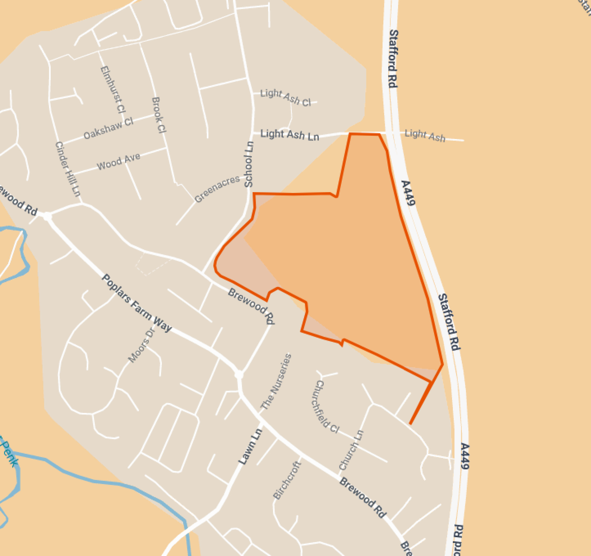
The 9.32ha site is located on the eastern side of the village of Coven, to the east of School Lane and at the rear of St Paul’s First School.
The site is bounded to the west, south and north by existing development, while the A449 Stafford Road provides the eastern boundary of the site. It therefore represents a sustainable and suitable location for sensitive residential development as a grey belt site. The site has predominantly been in arable agricultural use and is therefore of relatively low biodiversity value. The are existing matures trees and hedgerows, the majority of which will be retained, with the development parcels of the new neighbourhood shaped by existing field patterns.
There are a number of existing public rights of way crossing the site – Brewood & Coven 37 and 0.907, as well as part of Bridleway 0.908. These will be retained and enhanced within landscaped green corridors.
Site location plan - click to enlarge
Planning policy context
Increased housing targets for South Staffordshire
The site was previously promoted through the emerging South Staffordshire District Council Local Plan review. Since the Local Plan review process commenced, the new Labour government has introduced a new National Planning Policy Framework (NPPF). This has increased the number of homes that need to be delivered in South Staffordshire from 223 to 651 new homes per year.
Grey belt
A new grey belt policy was introduced in the NPPF. This allows development in less significant areas of the green belt, provided certain criteria are met. Grey belt includes land that ‘does not strongly contribute’ to green belt purposes which are set out in the NPPF. The site at Grange Farm is surrounded by existing development to the north, west and south, and is enclosed from the open countryside by the A449 Stafford Road to the east. It therefore meets the criteria for grey belt land and is being brought forward for a sustainable infill residential development on this basis.
Five-year housing land supply
The new NPPF also requires that South Staffordshire District Council is able to demonstrate a five-year housing land supply. This is the amount of land that the Council must identify to ensure there are sufficient deliverable sites for residential development over the next five years. South Staffordshire District Council currently has 1.17 years housing land supply, leaving a significant shortfall. In light of this, an outline planning application for grey belt land at Grange Farm is now being brought forward to contribute to meeting this housing delivery shortfall at a sustainable, infill location.
An outline planning application establishes the broad principles of development, such as access arrangements, illustrative concept layout, number of homes and general extent of development.
If outline planning consent is granted, a detailed planning application called a Reserved Matters planning application would be prepared. This would include more detail such as architecture, materials, detailed layout and landscaping, and would be subject to further consultation with the local community before being submitted for determination. Both outline and Reserved Matters planning applications are subject to Statutory Consultation carried out by the Local Planning Authority (South Staffordshire District Council).
Site constraints and opportunities
How local features and landscape have shaped our thinking for the proposed layout of the new neighbourhood.
In preparing the concept layout for the site, the technical team appointed by Bloor Homes first of all considered the landscape, biodiversity features, topography and local context of the site. The following plan shows some of the features and constraints that have informed the emerging outline proposals. Key features include important mature trees and existing field patterns, public rights of way that cross the site, and the A449 to the east of the site.
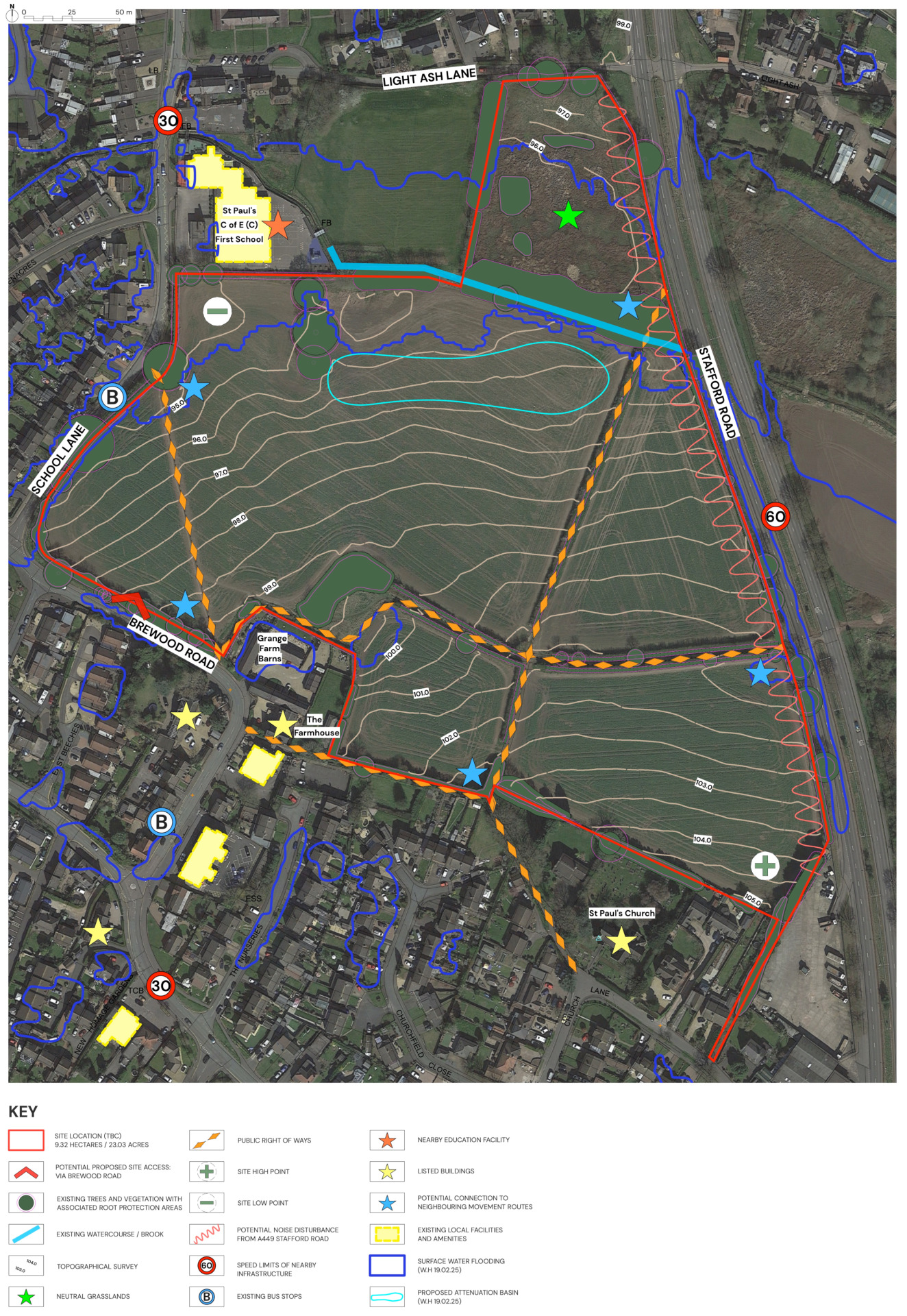
This plan shows an early analysis of some of the site features that have influenced the evolving masterplan for the site - click to enlarge
The emerging proposals for new homes and extensive public open spaces
Bloor Homes has submitted an outline planning application for sensitive and sustainable residential development at Grange Farm, which would provide:
- Up to 150 high-quality family and affordable homes.
- 50% of the new homes would be classified as affordable housing in line with grey belt policy.
- There is the potential to provide accessible homes and bungalows as part of the housing mix if local feedback indicates a need.
- Vehicular access to the new neighbourhood would be taken via a new junction with Brewood Road.
- Community car parking facilities are proposed to provide improved access to village facilities.
- Extensive green public open spaces would be provided across the site, including:
- Green corridors linking a network of landscaped public greens
- Biodiversity areas
- Enhanced public rights of way
- Additional walking and cycling routes
- Community orchard
- Common with play area
- The neighbourhood will incorporate a sustainable drainage scheme (SuDS), with the potential to deliver improvements to existing local drainage.
- Existing mature trees and the majority of hedgerows will be retained, with additional planting significantly increasing tree cover across the site.
- The development will generate significant financial contributions to invest in local infrastructure such as healthcare, education etc. This will be determined in consultation with statutory bodies such as the local NHS Integrated Care Board, the local education authority, Local Highways Authority, Lead Local Flood Authority, etc.
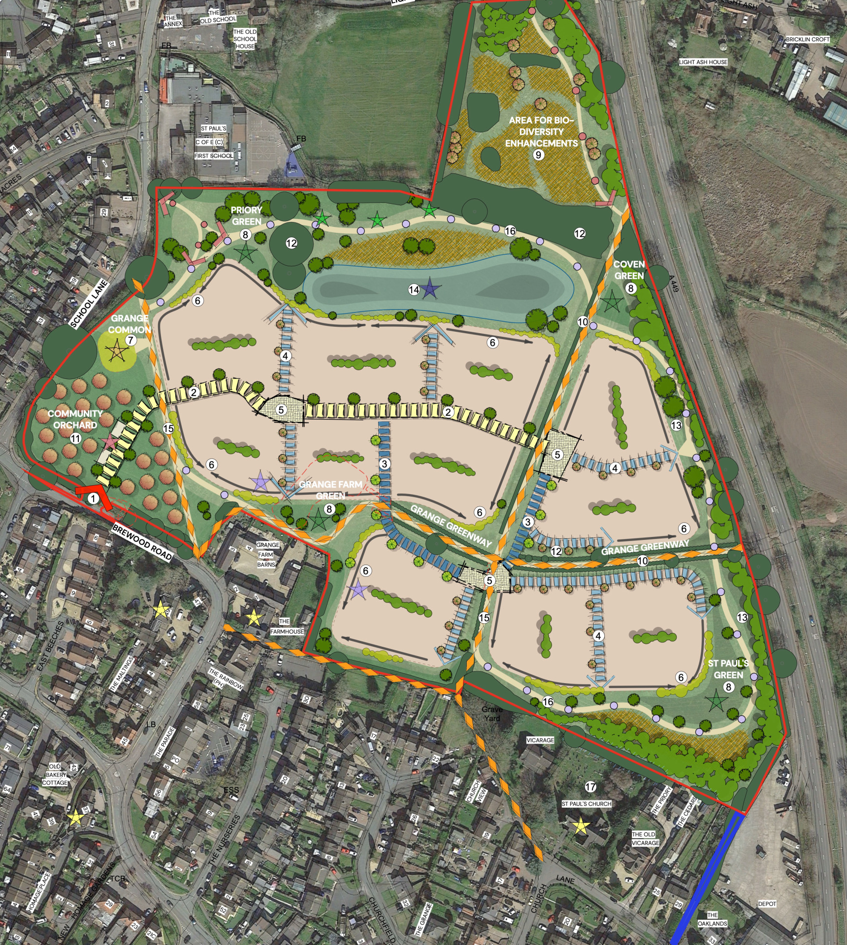
Illustrative outline layout of the proposed new neighbourhood – click to open view the proposals on our interactive map
Homes and community facilities
House types
The planning application is an outline planning application. This type of planning application sets out the broad principles of development, such as maximum number of homes, an illustrative layout and site access arrangements. Should outline planning permission be received, finer details such as specific house types, detailed layout, architecture etc would be subject to a subsequent further planning application (called a Reserved Matters planning application). This would involve further consultation with the community.
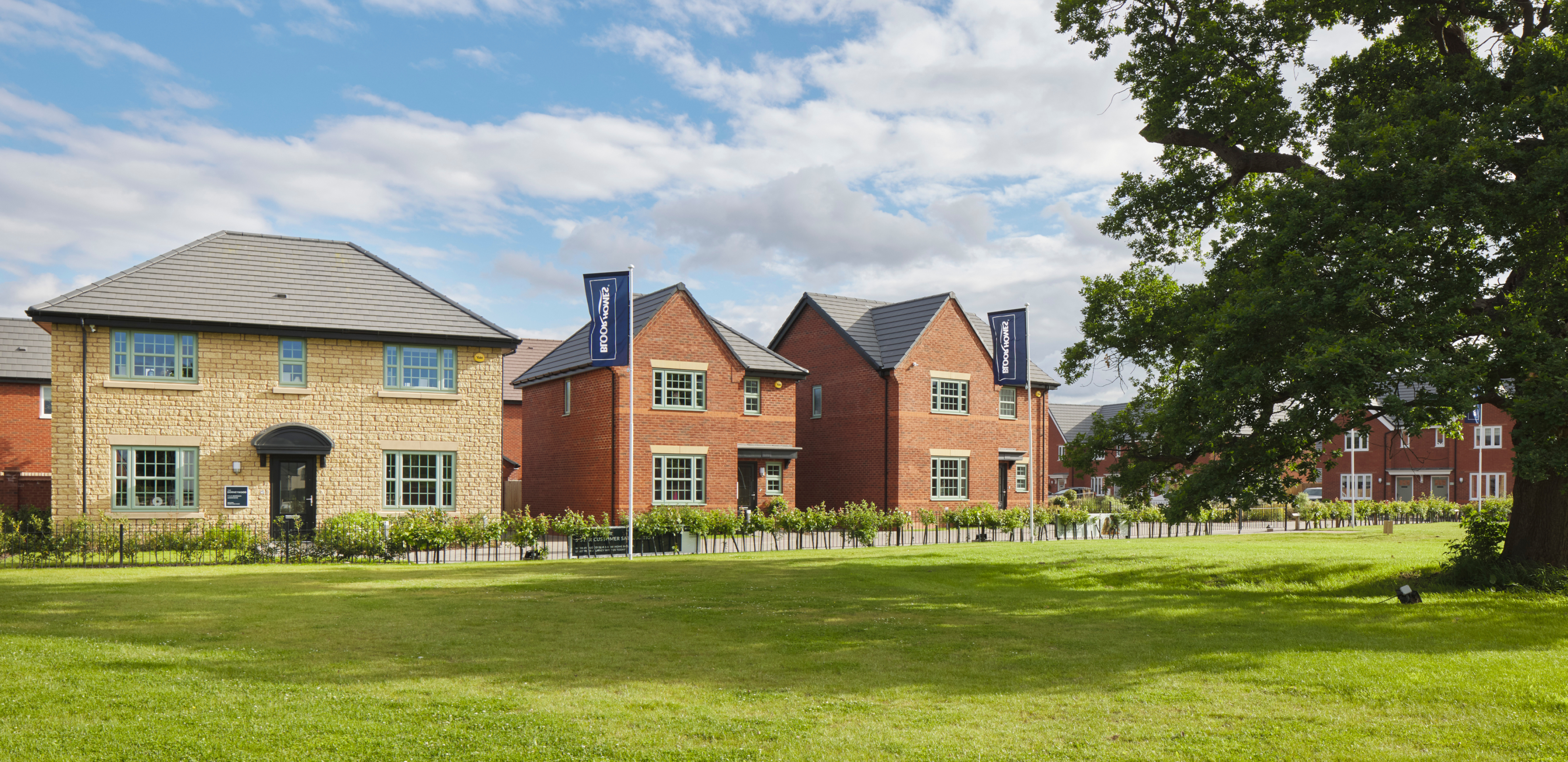
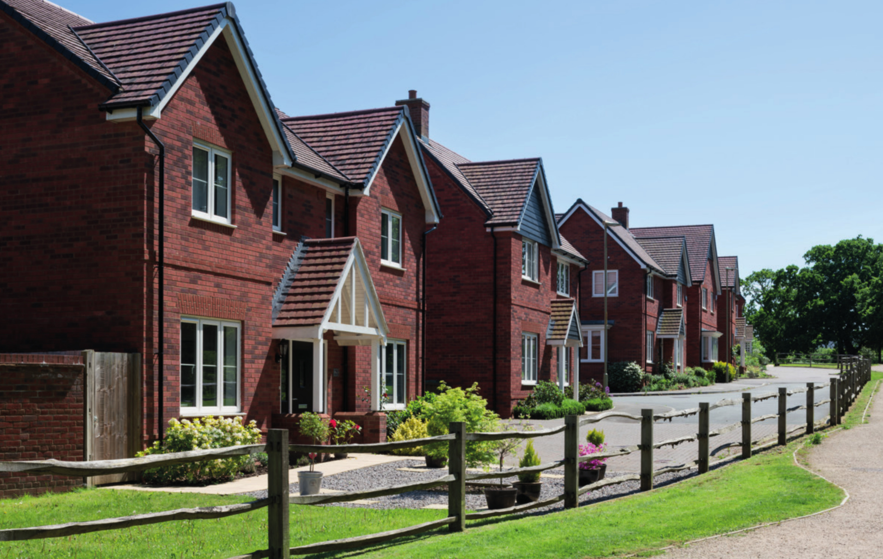
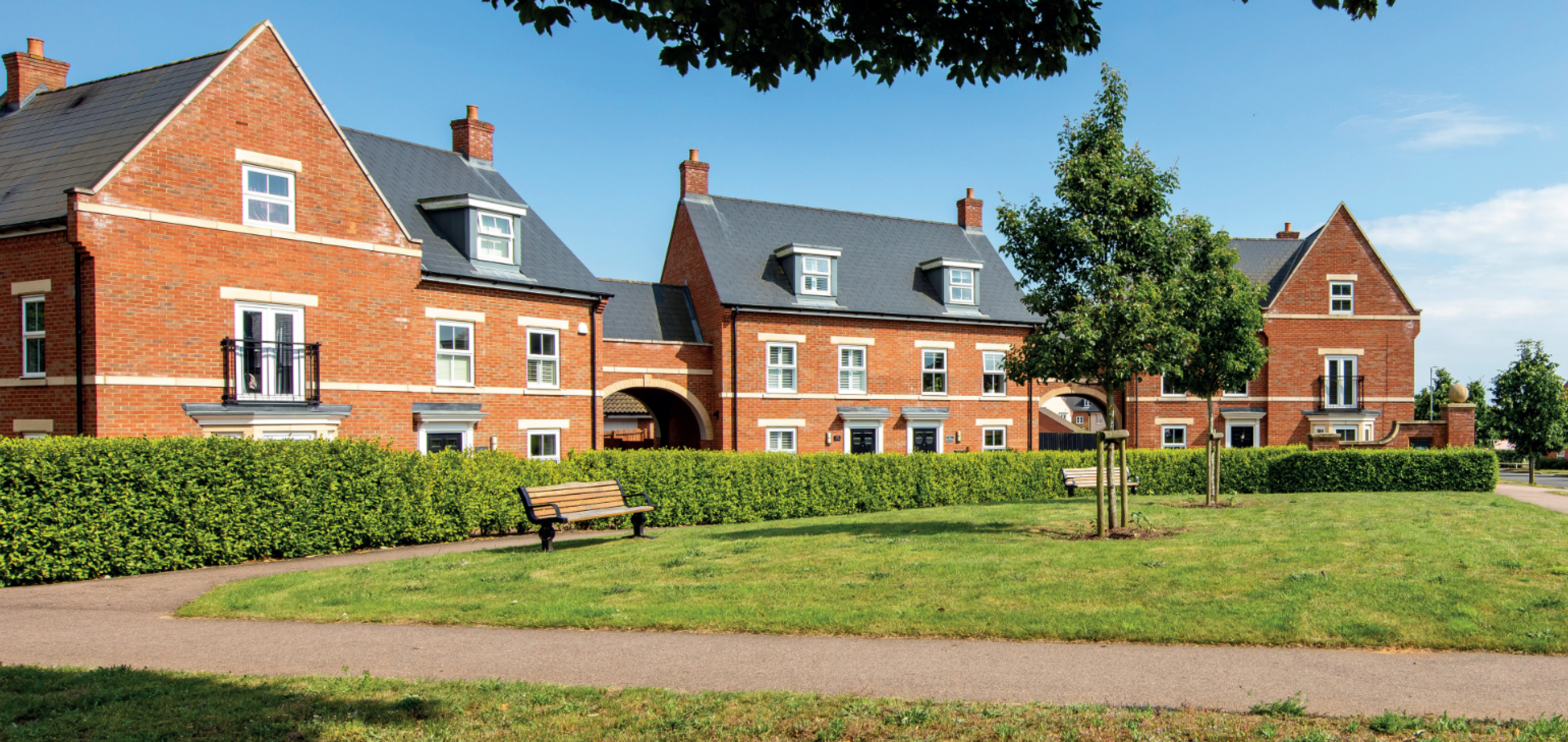
While house types would be determined at the Reserved Matters planning stage, we have provided imagery of existing Bloor Homes developments on this website to provide an idea of the types of high-quality homes we build.
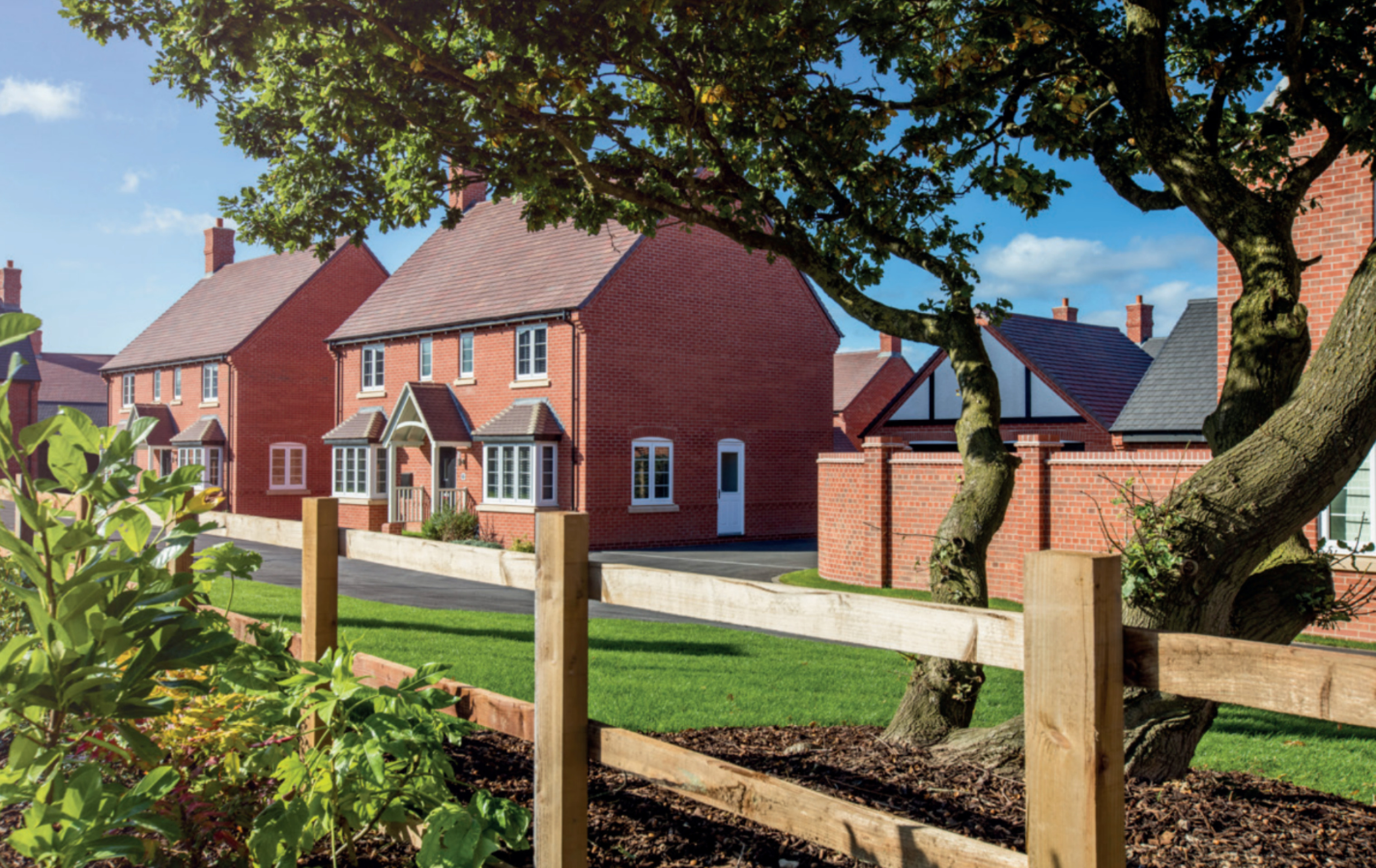
Examples of some recent Bloor Homes developments. Click to open a gallery of images.
Affordable homes
As the site is being proposed for development as a grey belt site, 50% of the new homes would be classified as affordable homes in line with national policy. This will provide opportunities for those on lower incomes with connections to the local area to secure a home of their own. Affordable housing is anticipated to be provided in a mix of affordable rent and shared ownership homes, however this will be determined in consultation with South Staffordshire District Council’s Housing Team.
We are happy to work with South Staffordshire District Council for Local Occupancy Criteria to be applied to the affordable housing provision, ensuring that it is prioritised for people with local connections.
Sustainable homes
We want to deliver homes that are sustainable now and contribute to a cleaner, greener future.
We know that sustainability is hugely important to communities across the country. The new homes for Coven will be built to the Future Homes Standard, resulting in a neighbourhood of net zero carbon ready homes.
The neighbourhood will be gas-free, with all homes provided with airsource heat pumps as standard. PV cells (solar panels) will also be incorporated, which along with the use of the latest materials and technique to maximise insultation, air tightness and heat recovery, will create an uplift in energy efficiency of 75-80%.
The new homes will incorporate sanitaryware and appliances that meet the highest water efficiency standards.
Electric vehicle (EV) charging points will be provided for all homes with on plot parking, together with access to communal EV charging points for the whole neighbourhood. We are also happy to approach commercial operators with a view to the provision of EV charging at the proposed community car park if there is local demand.
To minimise the impact of construction, we always aim to procure materials from sustainable sources and recycle construction waste as far as is possible.

The new homes for Coven will be net zero carbon ready
Investing in wider community infrastructure
A key consideration with a planning proposal such as this is to ensure that local services receive the investment they need to accommodate housing growth in the local area. The development will generate investment into local infrastructure such as healthcare and education, and this will be informed by consultation carried out by South Staffordshire District Council with statutory bodies such as the local NHS Integrated Care Board and the local education authority and will be secured via legal agreement between Bloor Homes and the Council.
We learned from local discussions during our public consultation that Coven had previously benefited from NHS branch surgery provision at the Memorial Hall, which was recently withdrawn. We therefore initiated discussions with the NHS Integrated Care Board to see if there is scope for our development to assist with the reinstatement of this or a similar service, and these discussions are ongoing.

The development will generate significant funding for key infrastructure such as healthcare and education, to be determined in consultation with bodies such as the NHS, local education authority, etc
Access and highways
Vehicular access
Vehicular access to the proposed new neighbourhood is to be taken from Brewood Road along the southern perimeter of the site. This approach is the result of discussions with both the Local Planning Authority and the Local Highway Authority. It was determined that access from School Lane would not be suitable due to local concerns regarding on-street parking and operation of the school. Locating the access away from School Lane also enables the protection of important mature trees.
The access has been designed to local standards detailed in the Staffordshire County Council Residential Design Guide for a ‘minor residential access road’. This results in a 5.5m wide carriageway alongside 2m pedestrian footways on both sides of the access and 6m radii. This road type is detailed in the design guide as being suitable to serve up to 200 dwellings from a single point of access and will therefore be well in excess of the requirements for the proposed neighbourhood of circa 145 homes.
In line with the design guide, the site access is at least 40m (centre line to centre line) from the adjacent junction of School Lane and at least 20m (centre line to centre line) from the junction with West Beeches opposite. The access has also been sited along the site frontage within a natural gap in the hedge/tree line to minimise the loss of vegetation.
A speed survey has been undertaken on Brewood Road to help inform the design of the access. This highlighted that vehicles were travelling at the posted speed limit and the commensurate visibility splays based on this can be achieved from the access.
The access can accommodate the expected vehicles that would access the site (including refuse collections) and tracking assessments alongside a capacity assessment is provided with a Transport Assessment that forms part of the outline planning application.
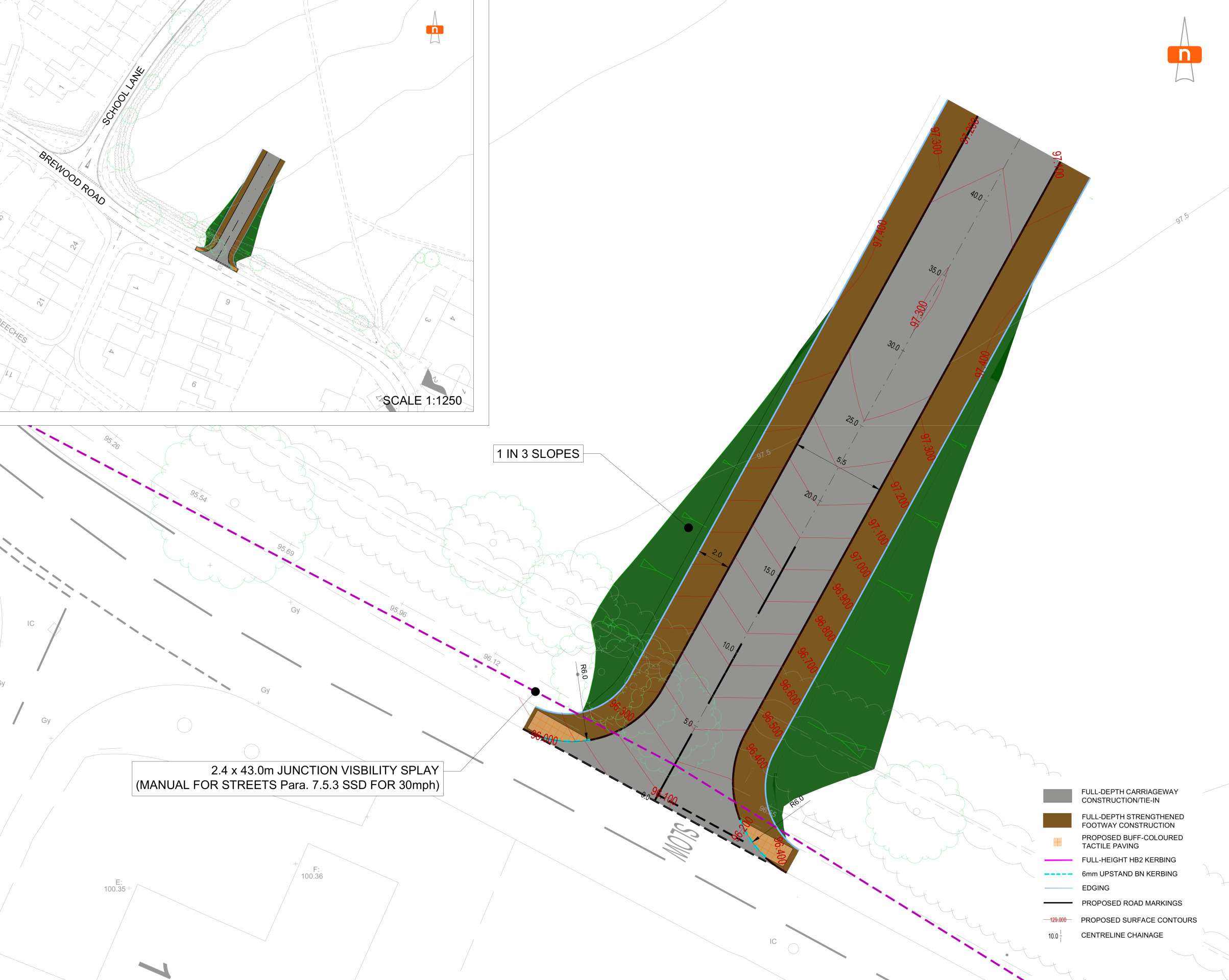
The vehicular access from Brewood Road - click to enlarge
Community car parking
A number of dedicated car parking space are proposed within the new neighbourhood, close to the access junction. This will provide public parking for those seeking to access nearby shops and village facilities.
Active travel
There are a number of existing public rights of way that cross the site. These are being retained within landscaped green corridors and enhanced to improve accessibility. In addition, a new network of walking and cycling routes will be provided within the neighbourhood, maximising the opportunities for residents to access local services by sustainable, active means.
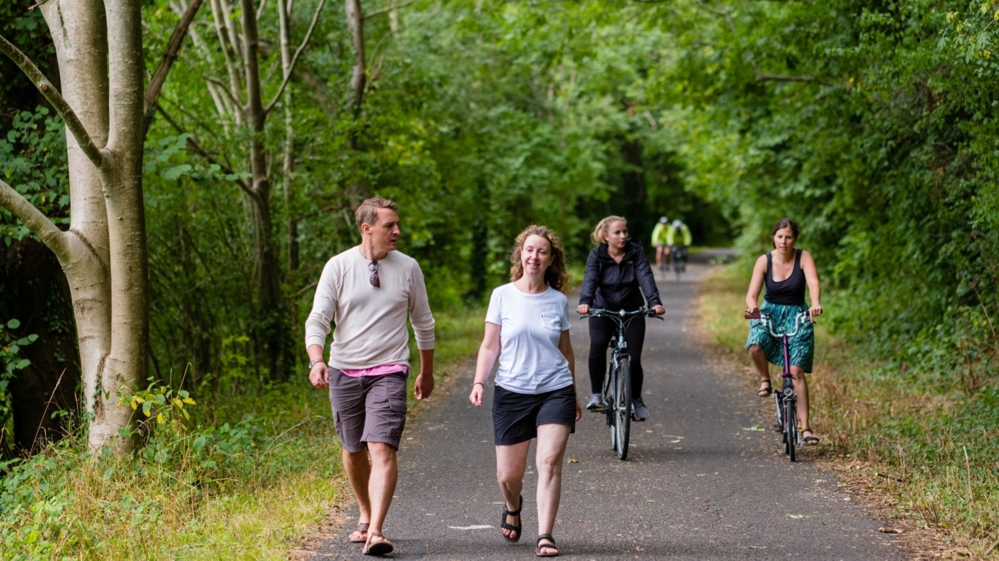
Public rights of way are being retained and enhanced, along with the provision of new walking and cycling routes - click to enlarge
Green infrastructure
We want to ensure that natural habitats are protected while we deliver new homes for people and families.
We are conscious of the ever-increasing importance of ensuring that development is sustainable, protecting and enhancing natural habitats and green infrastructure as much as possible whilst delivering much needed homes for people and families.
Alongside the delivery of much needed high-quality new homes, the proposed development will also see a significant proportion of the overall site area retained as open space, including extensive landscaped public open space, providing public recreational opportunities and areas for biodiversity enhancement.
Existing mature trees and the majority of hedgerows will be retained as part of the open space proposals with development parcels shaped by existing field patterns, and these will be enhanced with extensive additional planting. This will significantly increase tree cover across the site.
The site is currently largely comprised of improved agricultural land, which is of relatively low value in terms of biodiversity. The retention of existing trees and the majority of hedgerows, along with the planting of new trees and other plants and the use of sustainable drainage features to create new wetland features, will create new habitats. This will significantly boost the biodiversity value of the site, delivering Biodiversity Net Gain (BNG).
A network of walking and cycling routes will be set within the extensive new public open space which will also provide a range of open space community facilities such as a play area, community orchard, allotments, and greens for informal play and recreation.
Building with Nature
Bloor Homes is proud to be a member of the Homes for Nature programme. This will see the installation of nesting bricks/boxes in every new home and hedgehog highways between gardens.

Drainage
Surface water drainage
The Environment Agency’s Flood Map for Planning confirms that the whole site is located within flood zone 1 and is therefore at the lowest risk of flooding from rivers or streams. However, there are areas of surface water flooding to the north of the site and immediately adjacent to an existing ditch. Development will avoid these areas.
A sustainable drainage system (SuDS) will attenuate surface water runoff from the new neighbourhood, ensuring that surface water discharge rates do not exceed existing levels and where possible provide betterment over the existing surface water drainage on the site and in the surrounding area. The proposed attenuation area will also deliver biodiversity benefits through the provision of additional wetland habitat.
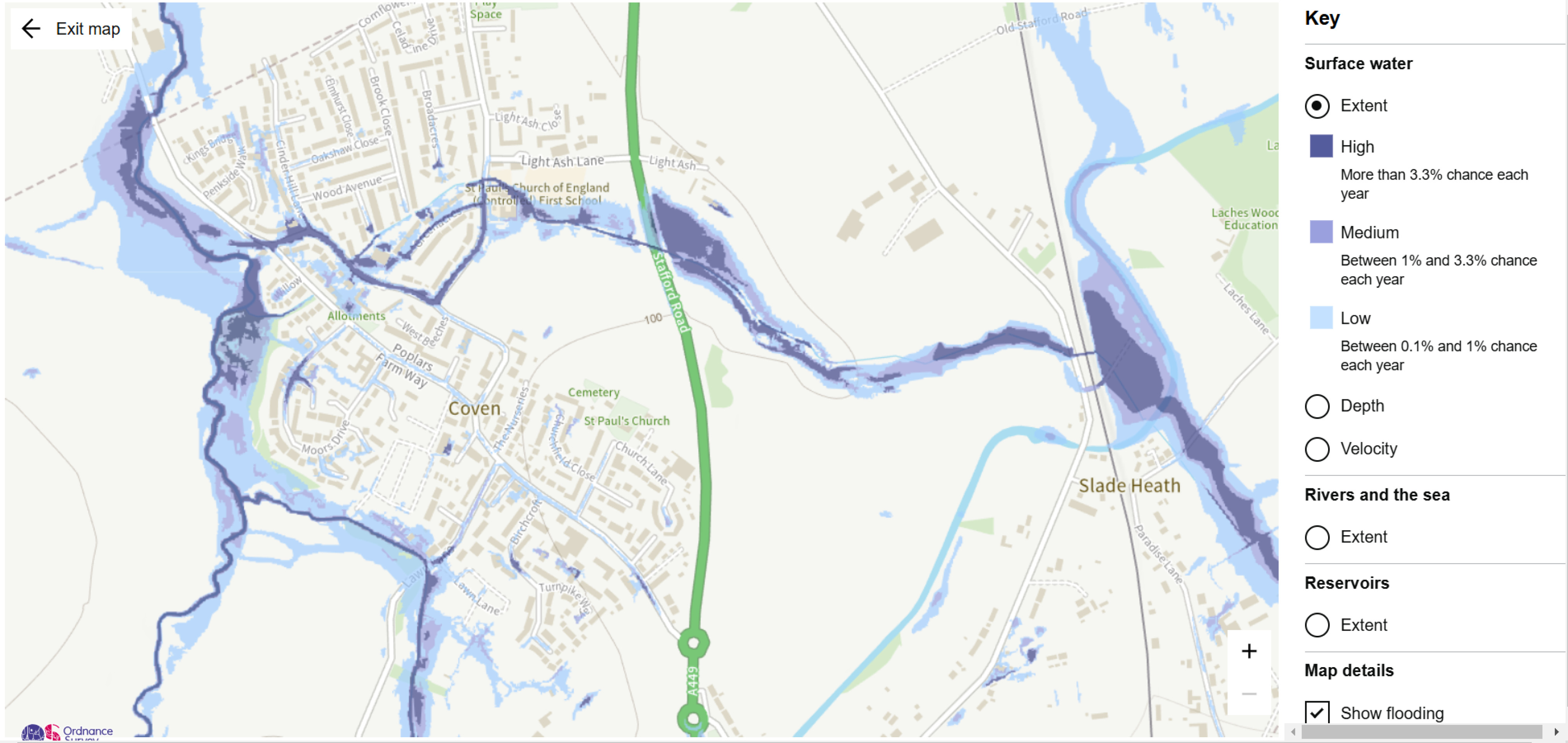
The Environment Agency’s surface water flood map for Coven. There will be no development in areas to the north of the site at risk of surface water flooding, and a sustainable drainage system for the development will seek to improve local drainage over the existing situation - click to enlarge
The sustainable drainage system for the new neighbourhood will also provide biodiversity benefits through the provision of wetland habitat.
Heritage
There are a number of important Grade II listed buildings to the south of the site, including St Paul’s Church, Grange Farmhouse and The Beeches. The layout has been designed to protect these heritage assets with landscape buffering, such as the provision of landscape planting and green public open space north of the church.
A full Heritage Assessment has been prepared to form part of the outline planning application.
Noise
The presence of the A449 Stafford Road to the east of the site has been considered in designing the illustrative site layout. Appropriate landscape buffering will be provided along the eastern boundary, with significant additional planting. A full Noise Assessment has been prepared to form part of the outline planning application.
Construction Management Plan
To ensure that the impact of construction is kept to a minimum, a Construction Management Plan is being prepared and will form part of the planning conditions of any outline planning permission.
Other technical considerations
In preparing an outline planning application for the proposed development, a full suite of technical studies has being completed, including Highways, Flooding and Drainage, Ecology, Utilities, Noise, Heritage, Contamination etc. These demonstrate that there are no significant technical constraints to delivering a high quality, sustainable new neighbourhood at this site.